Embarking on a road trip can be an exhilarating experience, filled with adventure and the promise of new discoveries. However, navigating unfamiliar roads and territories can present significant challenges. Fortunately, modern technology offers a plethora of navigation solutions designed to make your journey smoother and more enjoyable. From dedicated GPS devices to sophisticated smartphone apps, these tools have revolutionized the way we plan and execute our road trips.
As the landscape of navigation technology continues to evolve, travelers are presented with an ever-expanding array of options. Each solution brings its own set of features and benefits, catering to different needs and preferences. But with so many choices available, how do you determine which navigation tool is the most reliable for your next adventure on the open road?
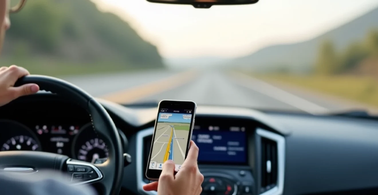
GPS hardware devices for reliable road trip navigation
While smartphone apps have gained tremendous popularity, dedicated GPS devices still hold a significant place in the world of road trip navigation. These purpose-built devices offer robust features and reliable performance, often excelling in areas where smartphone apps may fall short. Let's explore some of the top GPS hardware options that can serve as your trusty co-pilot on your next journey.
Garmin DriveSmart 65: advanced features and real-time traffic updates
The Garmin DriveSmart 65 stands out as a premium navigation device that combines cutting-edge technology with user-friendly design. This GPS unit boasts a large, high-resolution 6.95-inch display that provides crisp and clear visuals, even in bright sunlight. One of its standout features is the integration of real-time traffic updates, which can help you avoid congestion and reach your destination more efficiently.
What sets the DriveSmart 65 apart is its advanced voice control capabilities. You can simply say "OK Garmin" to activate voice commands, allowing for hands-free operation while driving. This feature significantly enhances safety by minimizing distractions. Additionally, the device offers:
- Detailed 3D maps of complex interchanges
- TripAdvisor ratings for points of interest
- Bluetooth connectivity for hands-free calling
- Built-in Wi-Fi for easy map and software updates
TomTom GO Discover: 3D maps and lane guidance technology
The TomTom GO Discover is another formidable contender in the GPS hardware market. This device excels in providing crystal-clear navigation with its high-definition maps and 3D visualization of complex junctions. The Lane Guidance technology is particularly useful for navigating unfamiliar highways, ensuring you're in the correct lane well in advance of your exit or turn.
One of the GO Discover's unique features is its ability to update maps over Wi-Fi, ensuring you always have the latest road information at your fingertips. The device also offers:
- World maps with free lifetime updates
- Speed camera alerts to help you stay within legal limits
- Integration with smartphone assistants like Siri and Google Now
- Last Mile Navigation for walking directions to your final destination
Magellan RoadMate 5635T-LM: lifetime map updates and traffic alerts
The Magellan RoadMate 5635T-LM is a reliable choice for those seeking a straightforward and effective navigation solution. This device offers a 5-inch touchscreen display and comes with the promise of lifetime map updates, ensuring your navigation data remains current without additional costs. The inclusion of free lifetime traffic alerts is a valuable feature that can help you avoid delays and choose the most efficient routes.
The RoadMate 5635T-LM also includes several user-friendly features such as:
- OneTouch favorites menu for quick access to frequent destinations
- Junction view with lane assistance for complex interchanges
- Phantom ALERT database for red light camera and speed trap warnings
- Multi-destination routing for efficient trip planning
Smartphone navigation apps for seamless travel
While dedicated GPS devices offer robust features, smartphone navigation apps have gained immense popularity due to their convenience and frequent updates. These apps leverage the power of your smartphone's hardware and internet connectivity to provide comprehensive navigation solutions. Let's explore some of the most reliable smartphone apps for road trip navigation.
Google Maps: offline functionality and real-time crowd-sourced data
Google Maps has become synonymous with digital navigation, and for good reason. This versatile app offers a wealth of features that make it an excellent choice for road trips. One of its most valuable attributes is the ability to download maps for offline use, which is particularly useful when traveling through areas with poor cellular coverage.
Key features of Google Maps include:
- Real-time traffic information and route adjustments
- Detailed information about businesses, including opening hours and reviews
- Street View for visual confirmation of destinations
- Integration with Google Search for easy discovery of points of interest
The app's crowd-sourced data contributes to its accuracy and up-to-date information, making it a reliable companion for your journey.
Waze: community-driven alerts and alternate route suggestions
Waze takes a unique approach to navigation by harnessing the power of its user community. This social navigation app allows users to report traffic incidents, police presence, and road hazards in real-time. This crowd-sourced information is then used to provide the most efficient routes and timely alerts to other drivers.
Some standout features of Waze include:
- User-reported road closures and construction updates
- Integration with music streaming services for in-app control
- Carpool options to help reduce traffic and emissions
- Voice commands for hands-free operation
Waze's community-driven approach often results in more up-to-the-minute information compared to traditional navigation apps, making it an excellent choice for avoiding unexpected delays.
Apple Maps: flyover feature and siri integration for hands-free navigation
For iOS users, Apple Maps offers a seamless navigation experience with deep integration into the Apple ecosystem. The app has made significant strides in recent years, improving its accuracy and feature set. One of its unique offerings is the Flyover feature, which provides immersive 3D views of major cities, helpful for orientation in urban environments.
Apple Maps excels in:
- Siri integration for voice-controlled navigation
- Indoor maps of airports and shopping centers
- Look Around feature for street-level imagery (similar to Google's Street View)
- Privacy-focused design with features like random identifiers for location searches
The tight integration with iOS devices makes Apple Maps a convenient choice for iPhone users, offering a smooth and intuitive navigation experience.
HERE WeGo: comprehensive public transit information and offline capabilities
HERE WeGo is a robust navigation app that stands out for its excellent offline functionality and comprehensive public transit information. This makes it an ideal choice for travelers who may need to switch between driving and public transportation during their journey.
Key features of HERE WeGo include:
- Offline maps for over 100 countries
- Detailed public transit routes and schedules
- Car sharing and taxi options in supported cities
- Turn-by-turn voice guidance for walking and cycling
The app's ability to function seamlessly offline and provide multi-modal transportation options makes it a versatile choice for diverse travel needs.
Specialized road trip planning apps
While general navigation apps cover the basics of getting from point A to point B, specialized road trip planning apps offer additional features tailored to enhance the overall travel experience. These apps focus on the journey as much as the destination, helping you discover interesting stops and manage the logistics of your trip.
Roadtrippers: customized route planning with points of interest integration
Roadtrippers is an app designed specifically for road trip enthusiasts. It allows you to plan your route and discover interesting attractions, natural wonders, and hidden gems along the way. The app's comprehensive database of points of interest can help turn a simple drive into an adventure filled with unexpected discoveries.
Notable features of Roadtrippers include:
- Collaboration tools for planning trips with friends
- Estimated fuel costs based on your vehicle's efficiency
- Integration with booking platforms for accommodations
- Offline access to your planned trips and maps
By focusing on the journey itself, Roadtrippers helps create a more immersive and enjoyable road trip experience.
iExit Interstate Exit Guide: detailed information on highway services and amenities
For those embarking on long highway journeys, iExit Interstate Exit Guide is an invaluable tool. This specialized app provides detailed information about upcoming exits, including available services, restaurants, and gas stations. It's particularly useful for planning pit stops and ensuring you don't miss the last opportunity for fuel or food before a long stretch of highway.
Key features of iExit include:
- Real-time gas prices at upcoming exits
- Filters for finding specific amenities (e.g., pet-friendly hotels, diesel fuel)
- Integration with popular navigation apps for seamless routing
- Favorites list for frequently visited exits or chains
By providing such specific and relevant information, iExit helps make long highway drives more comfortable and efficient.
GasBuddy: fuel price comparison and station locator for cost-effective travel
GasBuddy is a must-have app for cost-conscious road trippers. Its primary function is to help users find the cheapest gas prices in their vicinity or along their route. This can lead to significant savings, especially on long trips where fuel costs can add up quickly.
GasBuddy offers several useful features:
- User-reported gas prices for up-to-date information
- Trip cost calculator based on your vehicle and route
- Fuel log to track your vehicle's fuel efficiency
- Rewards program for savings on gas purchases
By helping you find the best fuel prices, GasBuddy can contribute to a more budget-friendly road trip experience.
Integration of navigation devices with vehicle infotainment systems
As vehicle technology advances, the integration of navigation systems with in-car infotainment systems has become increasingly seamless. This integration offers a more cohesive and safer driving experience by allowing drivers to access navigation features through their vehicle's built-in display and controls.
Apple CarPlay: seamless iphone integration for navigation and communication
Apple CarPlay brings the familiar interface of iOS to your car's infotainment system. This integration allows you to use navigation apps like Apple Maps or Google Maps directly on your vehicle's display, providing a larger screen and easier access to controls. CarPlay also offers voice command functionality through Siri, enabling hands-free operation for enhanced safety.
Key benefits of Apple CarPlay include:
- Access to your iPhone's contacts and messages for easy communication
- Integration with music and podcast apps for entertainment on the go
- Third-party app support for additional navigation options
- Automatic connection when your iPhone is plugged in or connected via Bluetooth
Android Auto: Google assistant-powered navigation and voice commands
Android Auto serves a similar purpose for Android smartphone users, bringing Google's ecosystem to your car's infotainment system. It offers seamless access to Google Maps and Waze for navigation, along with other compatible apps for music, messaging, and more. The integration of Google Assistant provides powerful voice command capabilities, allowing for truly hands-free operation.
Android Auto features include:
- Customizable interface with quick access to frequently used apps
- Google Assistant for voice-controlled navigation and information queries
- Integration with various messaging apps for safe communication while driving
- Automatic day/night mode for optimal visibility in different lighting conditions
Mirrorlink: universal smartphone-to-vehicle display technology
MirrorLink is a technology standard that aims to provide a universal solution for smartphone-to-vehicle integration. Unlike Apple CarPlay and Android Auto, which are specific to their respective operating systems, MirrorLink works with a variety of smartphone brands and car manufacturers. This makes it a versatile option for users who may switch between different types of devices or vehicles.
MirrorLink offers several advantages:
- Compatibility with a wide range of smartphone brands and car models
- Access to certified apps designed for in-car use
- Standardized controls for consistent user experience across different vehicles
- Potential for broader app ecosystem due to its open nature
Emerging technologies in road trip navigation
The field of navigation is continually evolving, with new technologies promising to revolutionize how we plan and execute our road trips. These emerging technologies aim to provide more intuitive, accurate, and immersive navigation experiences.
Augmented Reality (AR) navigation: overlaying directions on live camera views
Augmented Reality navigation is poised to transform the way we interact with navigation systems. By overlaying directional information and points of interest on a live camera view of the road ahead, AR navigation provides a more intuitive and context-aware guidance system. This technology can help drivers better understand complex intersections and more easily identify their correct route in unfamiliar areas.
Potential benefits of AR navigation include:
- Reduced cognitive load by presenting information in the driver's line of sight
- Enhanced pedestrian and obstacle detection for improved safety
- Integration with real-time traffic data for dynamic route adjustments
- Seamless identification of points of interest along the route
AI-powered predictive routing: machine learning algorithms for traffic prediction
Artificial Intelligence and machine learning are being leveraged to create more accurate and dynamic routing systems. These technologies analyze vast amounts of historical and real-time data to predict traffic patterns and suggest optimal routes. AI-powered systems can take into account factors such as time of day, weather conditions, and even local events to provide highly accurate travel time estimates and route recommendations.
Key advantages of AI-powered routing include:
- More accurate arrival time predictions
- Proactive rerouting based on predicted traffic patterns
- Personalized route suggestions based on individual driving habits
- Improved efficiency in multi-stop trip planning
V2X communication: real-time data exchange for enhanced navigation
Vehicle-to-Everything (V2X) communication represents a significant leap forward in navigation technology. This system allows vehicles to communicate with each other and with infrastructure elements such as traffic lights and road signs. By exchanging real-time data about road conditions, accidents, and traffic flow, V2X technology can provide more accurate and up-to-the-second navigation information.
Potential applications of V2X for navigation include:
- Immediate alerts about accidents or hazards ahead
- Coordination with traffic signals for optimal flow through intersections
- Dynamic speed recommendations based on current road conditions
- Enhanced route planning taking into account real-time data from other vehicles
As these emerging technologies continue to develop and integrate with existing navigation systems, road trip navigation is set to become even more intelligent, efficient, and user-friendly. These advancements promise to make road trips safer, more enjoyable, and more tailored to individual preferences.
As we look to the future of road trip navigation, it's clear that the integration of multiple technologies will play a crucial role. The combination of AR for intuitive visual guidance, AI for predictive routing, and V2X for real-time data exchange has the potential to create a navigation experience that is not only more accurate but also more responsive to the dynamic nature of road travel.
However, it's important to note that while these technologies offer exciting possibilities, they also come with challenges. Issues such as data privacy, system reliability, and the need for widespread adoption of V2X technology will need to be addressed as these systems become more prevalent.
For road trip enthusiasts, the evolution of navigation technology means more than just getting from point A to point B efficiently. It represents an opportunity to enhance the overall travel experience, making discovery and exploration easier and more spontaneous. As these technologies mature, we can look forward to road trips that are not only more convenient but also more enriching and tailored to our individual interests and preferences.
Whether you prefer the reliability of a dedicated GPS device, the convenience of a smartphone app, or are excited about the potential of emerging technologies, the future of road trip navigation is bright. By staying informed about these advancements and choosing the tools that best suit your needs, you can ensure that your next road trip is not just a journey, but an adventure filled with discovery and enjoyment.